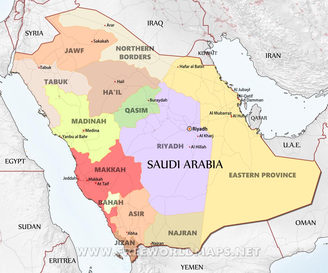
Saudi Arabia is located in the Middle East. Saudi
Arabia is bordered
by and the Red Sea to the west, Yemen and Oman to the south, the Arabian Gulf, Qatar
and
United Arab Emirates to the east, and Kuwait, Iraq, and Jordan to the north.
Google Earth
is a free
program from Google
that allows you to explore satellite images showing
the cities and landscapes of Saudi
Arabia
and all of
Asia in
fantastic
detail. It works on your desktop computer, tablet, or mobile phone. The
images in many
areas are
detailed enough that you can see houses,
vehicles and even people on a city street. Google
Earth
is free and
easy-to-use.
Saudi Arabia is one
of nearly 200
countries illustrated on our Blue Ocean Laminated Map of the World. This
map shows a combination of political and physical features. It includes
country boundaries,
major cities, major mountains in shaded relief, ocean
depth in blue color gradient, along
with many other features. This is a
great map for students, schools, offices and anywhere
that a nice map of
the world is needed for education, display or decor.
If you are
interested in
Saudi Arabia and the geography of Asia our large laminated map of Asia
might
be
just what you need. It is a large political map of Asia that also
shows many of the
continent's
physical features in color or shaded relief.
Major lakes, rivers,cities, roads, country
boundaries, coastlines and
surrounding islands are all shown on the map.